
INTERREG III B CADSES
project part-financed by the European Union
|
INTERREG III B CADSES project part-financed by the European Union |
Emilia-Romagna GIS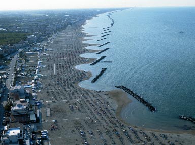
The Coast Information system (SIC) was implemented as part of the EU Cadsealand Project (2004-2006) in order to support the Integrated Coastal Zone Management programme carried out by Emilia-Romagna regional authority during last 4 years.
The database design was referred to the guidelines issued by European Commission within EUROSION programme (eu commission, 2004).
Currently SIC contains most important topics referable to the physical coastal system (geology, geomorphology, land use, etc) and tools for coastal risk evaluation.
Within Plancoast project the GIS procedures and set of other data required by spatial planning processes in coastal and maritime zones will be difined and aquired. In the second stage this data will be applied in the Plancoast pilot project in WP4 (Sea-Use-Planning)
Schedule
Download section
|
|---|
